 Religious geometry in prehistory
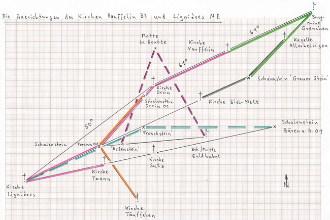
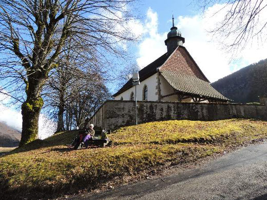
The orientation of the church in Vauffelin BE (61°) points to the ruins of the castle Grenchen/Bettlach SO (clearly constructed on a former earthwork) and backwards to the church in Orvin
BE.
This is remarkable but not extraordinary, yet it leads to a very interesting "triangular net".
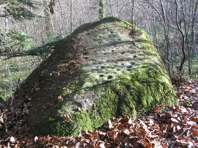
The castle Grenchen is equidistant (8.30 km, always measured horizontally) from the church in Vauffelin and from the erratic stone 'Grauer Stein' ('Grey stone')/Pieterlen BE, a named 'cup stone'
with one cup (591.580/223.750).
The straight line castle Grenchen - 'Grauer Stein' passes via the chapel 'Allerheiligen'/Grenchen SO, and 'Grauer Stein' is equidistant (4.66 km) from this chapel and from
the very ancient church Biel-Mett BE (587.310/221.790). <By the way, this church is orientated with 38.5° (nave) backwards to the cup stone 'Sumpfstein'/Sutz-Lattrigen BE, as is the church in
Ins BE (forward); ref. Ausrichtung der Kirchen (Berner Seeland).>
The prolongation of the straight line 'Grauer Stein' - church Biel-Mett leads exactly to the (important) cup stone 'Twannberg' (Twann BE 01, 578.320/217.640). <The
orientation of the nave of the church in Nidau BE (73°) also points backwards to this cup stone.>
Now the church in Orvin is, most probably not by chance, equidistant (7.28 km) from the church in Vauffelin and from the cup stone 'Twannberg' !
The straight line church Orvin - cup stone 'Twannberg' passes via the cup stone Orvin 01 (582.315/222.187), and the cup stone 'Twannberg' is equidistant (6.01 km) from
this cup stone and from the church in Täuffelen BE.
The same distance of 7.28 km between church Orvin and cup stone 'Twannberg' we find a third and a forth time between the church in Lignières NE and the cup stone 'Twannberg' and also the church
in Twann.
The orientation of the church in Lignières (50°) points exactly to the church in Orvin which is equidistant (14.3 km) from the church in Lignières and from the church in Siselen BE (however
outside the diagram).
The straight line church Lignières - church Twann proceeds to the church of Sutz and then to the cup stone on the 'Städtiberg' Büren 01/Büren a.A. (593.939/219.390).
Somewhat surprisingly, we find the 'Froschstein' ('frog stone')/Tüscherz BE (582.295/219.310), which also has an artificial cup, precisely equidistant (11.60 km) from the cup stone Büren 01 and
from the church in Lignières. The frog seems to have a particular signification in the prehistoric period, and this stone monument may have been constructed artificially.
The equidistance of the 'Froschstein' is not fortuitous because the same distance of 11.60 km is found interconnected another three times (but all outside the diagram): between the cup stone
Büren 01 and the small earthwork Zamberg/Rapperswil BE (600.250/209.580, hardly "early medieval"), between the earthwork Zamberg and the massive motte Aarberg BE (P.491, 588.590/210.110), where
there was, maybe, never a castle, and between this motte and the spring cave 'Römerquelle' in Biel (585.315/221.310).
Other interesting equidistances (also outside the diagram): the castle Grenchen is equidistant (15.63 km) from the church in Orvin and from the former motte 'Burg'/Messen SO (601.300/214.605)
which was the central point of the studies Four (five) Churches
Orientated to the same Motte I and II ! And then this motte 'Burg' is again equidistant from the castle Grenchen and from the church Biel-Mett !
The chapel 'Allerheiligen' is equidistant (9.16 km) from the church Biel-Mett and from the prominent cup stone Hessigkofen 01 (601.765/221.050, outside the diagram).
Also outside the diagram: the cup stone 'Twannberg' is equidistant from 'Grauer Stein' and from the church in Seedorf BE, and the motte/former tower 'Guldhubel' ('gold hillock')/Aegerten BE
(P.443.5,587.815/218.485) equidistant from the cup stone 'Twannberg' and from the church in Seedorf.
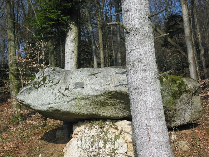
Interestingly, the straight line cup stone 'Twannberg' - motte 'Guldhubel' goes over 'Holenstein' ('hollow stone') ('Holustei' 580.392/217.825), a stone monument with a
little similarity to a dolmen, and the motte La Heutte BE (P.619.7, 583.350/226.499), which with the church in Courtelary BE and the cave 'Holiloch'/Twann forms an equilateral (!) triangle, is
now equidistant (9.00 km) from 'Holenstein' and 'Guldhubel'. One can presume that 'Guldhubel' was a prehistoric motte on which a medieval tower was built.
It seems hardly believable that all these precise geometrical relationships are only a product of chance and happening unintentionally. At the same time they underline the evidence that cup
stones, mottes, earthworks and many positions of churches and chapels date back to prehistoric times.
Write a comment